The mystery of the Hyperborean civilization
Hyperborea (aka Arctida), like Atlantis, died during the Great Flood (10,478 BC). After it, part of the land sank to the bottom, the climate became colder, and the people who inhabited Hyperborea, who managed to survive after the Flood, were forced to migrate to the southern territories, fleeing from the advancing glaciers. They even made it to India!
The ancient Indian epic Mahabharata contains many references to Mount Meru, “immeasurably high, not seen anywhere else in the worlds.” From the top of the mountain, a beautiful view of the Milk Sea (Arctic Ocean) opens up. Right above the mountain, in the center of the universe, Brahma motionlessly strengthened the North Star (Dhruva), around which the constellations Ursa Major (Seven Rishis), Cassiopeia (goddess Arundhati), and Bootes (Swati) move. The God of the radiant Sun, not leaving Meru for an hour, walks around it, “gives being and distributes it between everything mobile and immobile.” A day here lasts a year: half a year day, half a year night. “Captured”, “falling”, waters freeze “in beautiful forms”.
A strange story for sultry India, isn’t it? How in the south of Asia could they know about the North Star, which is stationary only above the North Pole? How did the creators of the epic learn about the polar day and night lasting for half a year, about frozen waters, “taking beautiful images” – ice and hummocks? Yes, and Apsaras – “shining crows, born of a rainbow” – why not a metaphor for the northern lights?
The collection of the sacred texts of the Zoroastrians “Avesta” is much older than the Indian epic. Here, too, there is the sacred mountain Hara Berezaiti (High Hara), which arose at the “beginning” of the world in the north “throughout the whole earth from west to east.” The Sun – Hvar, as well as the Moon and stars, constantly walk around it, and the gods live on top. An important feature: “They have a day – this is what is a year.” To get the latest stories, install our app here.
In the ancient “texts of the builders” inscribed on the walls of the temple of Horus in the Egyptian city of Edfu, it is told that the pyramids were built by some “enlightened ones” who arrived from the islands of the northern country of Duat-n-Ba, which suffered from a flood. It was they who became the founders of the Egyptian civilization. The priests of Ancient Egypt described Duat-n-Ba as a place where “the sun of the world hidden from us meets the sun of our world.” According to Egyptologists, the word “duat” means the red light of dawn before dawn. Such is the dawn at a latitude of 65° just in the North!
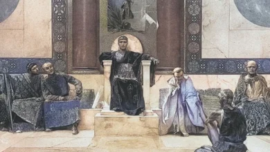
There is a lot of information about Hyperborea and the Hyperboreans among the ancient Greeks, but all of it is very “thought-out” and reworked since a lot of time has passed since the catastrophe.
Vague ideas about the northern ancestral home have been preserved among many peoples. The “Land of the Blessed” in the Arctic Ocean is mentioned in Scandinavian legends. The Finns, for example, call it “Saraias” – “Northern House”. And the Indians in Vedic times believed that their ancestors came from the country of Jarayos, where the night lasted a hundred days. Today, this is how long the polar night lasts at 77.4° north latitude – in the south of Svalbard or in the north of Taimyr. To get the latest stories, install our app here.
The same Greeks stubbornly placed behind the mountains (Riphean). Let’s check the original data again. Hyperborea must lie far to the north, in the Ocean, among the ice, behind high mountains, stretching from west to east, directly under the North Star (Indians and Iranians), where the world’s turning point is (Greeks). Astronomical parameters accurately indicate the geographic North Pole, but where can you find mountains similar to the Riphean ones?…
In 1948, the Soviet high-latitude air expedition “North”, with the participation of the famous oceanographer Yakov Gakkel, discovered a huge ridge at the bottom of the Arctic Ocean, which was named after Lomonosov. These mountains stretch from the New Siberian Islands to Ellesmere Island across the center of the ocean, near the pole.
The length of the mountain system is about 1800 km, the width is up to 200 km, the height is 3300–3700 m, the minimum depth above the ridge is 954 m. A year later, another ridge was discovered, named after Mendeleev. So, although at the bottom of the ocean, but at the address indicated by the ancients, there are high mountains directly under the North Star, stretching from west to east. Here is the “coagulated” or “milky” sea, and “water taking on beautiful forms”, and “days lasting a year”, and “flaming lights” – the northern lights.
In 2007, scientists explored the Lomonosov Ridge using deep-sea submersibles, took soil samples, and, for the first time in history, took pictures of the flooded land. The mountain slopes of the Lomonosov Ridge are cut by canyons; traces of wind erosion are clearly visible on them. This proves that the mountains hidden underwater today were once above the surface. And it was in historical time – about 40-15 thousand years ago (possibly later).
Biological data also testify in favor of the existence of Arctida, and in particular the surface position of the Lomonosov Ridge: a study of the fauna and flora of the polar regions.
Birds serve as a kind of indicator of the presence of such solid land. Returning to their summer nesting sites, they usually follow long-established paths and fly along the island ridges. So, the black goose, according to the observations of E. V. Toll, flies along the “transarctic route”, crossing the central Arctic in its polar region. Scientists see in this a habit that has not been erased by time for the old routes of flight mastered in antiquity. To get the latest stories, install our app here.
Another proof was provided by the spores of ancient plants found in the Arctic. Tropical forms are found among them! A number of artifacts in the subpolar zone are also widely known, at least proving the presence of human settlements and civilization. But that’s not all…
International oceanographers and paleontologists found that in the 30-15 millennium BC. the climate of the Arctic was quite mild, and the Arctic Ocean was warm, despite the presence of glaciers on the continent. The favorable climate near the coast of the “Milky Sea” was explained by the fact that in those distant times, the North Geographic Pole, together with the ice shell, was off the coast of Canada and Alaska, and only after the Flood (which radically changed the face of the planet) did it move to its current position, shifting by 15.5 degrees. In addition, before the Flood, Arctida was washed by the warm Gulf Stream…
At that time, the peaks of the Mendeleev, Lomonosov, and Gakkel ridges stood as a triple barrier in the Northern Ocean on the way of cold and ice to the Novaya Zemlya-Taimyr region. And the warm Gulf Stream reached and skirted Novaya Zemlya and reached Taimyr. Because of this, the climate was much milder than today. Along the Gakkel ridge, along with a series of islands, there was a route from Taimyr to northeastern Greenland. The recent existence of large islands of the Arctic lands in the northern ocean is evidenced by the maps of Mercator, compiled by him in the middle of the 16th century. AD based on older sources.
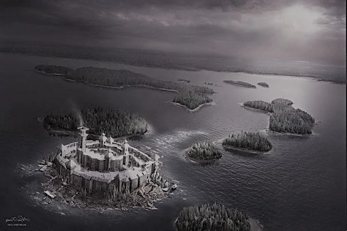
Indirect evidence in favor of the existence of an ancient highly developed civilization in the northern latitudes can be powerful stone structures and other megalithic monuments located here everywhere (the famous cromlech of Stonehenge in England, the alley of menhirs in French Brittany, the stone labyrinths of Solovki and the Kola Peninsula).
The Indians, after the gradual migration of their great ancestors from the North to the South, preserved the memory of the Polar Mountain Meru in almost all sacred books and majestic epic poems (later, ancient cosmological views were included in the Buddhist canon and images on sacred mandalas). To this day, rituals have been preserved (including marriage rituals) focused on the North Star and the flora of that Hyperborean one… Despite the fact that they have long lived in southern latitudes.
In the ancient Egyptian language, the pyramid was called mr, which is completely consonant with the name of the sacred mountain Meru (taking into account that there are no vowels in Egyptian hieroglyphics).
The results of recent research have made it possible to establish that as early as 12 thousand years ago, the Hyperboreans lived on Novaya Zemlya and adjacent islands. Novaya Zemlya was then a peninsula. Immediately after the Flood, the migration began. The descendants of the Hyperboreans reached India by about 7-8 millennium BC.
The legendary Hyperboreans were absolutely real people. Their distant descendants today live in Asia, and in Europe, and Africa. To get the latest stories, install our app here.