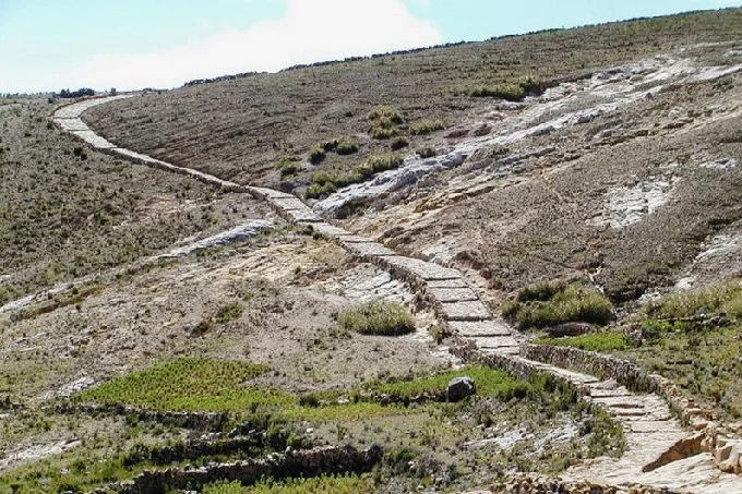
In just 100 years, Inca Empire built over 40,000 km of roads
Not many people, even those who understand history, understand how powerful and large the Inca empire was. And the Inca Empire was the largest in the Americas. The Aztecs and Mayans didn’t come close to this.
At the same time, it flourished, in fact, for only 100 years, from the 15th to the 16th centuries of our era. But at the peak of its power, it stretched from modern Quito (Ecuador) in the north, to Santiago (Chile) in the south.
Like the Roman Empire, the Incas laid extensive road systems wherever they went. These roads are now known as the “Royal Highway” or Qhapaq nan in the Inca language
The Inca roads reached over 40 thousand kilometers in length (according to other estimates, no more than 30 thousand), and they are still used by rural residents in countries such as Brazil, Peru, Bolivia, Chile, and Argentina.
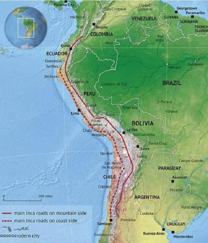
There were two main “highways” crossing the empire’s territories from north to south. One went along the coastal line, the other was internal and also crossed the highlands of the Andes. In addition to these roads, there were shorter secondary and even shorter third-level roads.
At the same time, it is worth noting that some Inca roads were not built from scratch, but only strengthened, and they were built by even more ancient civilizations, from which only crumbs of artifacts have reached us and whose names – Wari, Tiwanaku, and Chimu now tell few people anything.
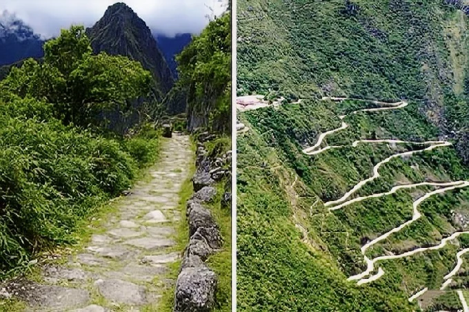
However, the Incas were the first to build roads in these places in difficult rocky landscapes. Their strong stone-lined roads crossed deep ravines and rivers, deserts, and mountains.
One such road runs through the entire Atacama Desert in Chile, and the other along the western shore of the high-altitude Lake Titicaca.
In addition to the roads, the Incas installed small “stations” called Chasquivasi on them at regular intervals. Large stations were placed at a distance of about 20 km from each other. Travelers could rest on them, eat and spend the night.
The roads were mainly used for the official needs of the state, especially for the movement of the army. To keep the empire in order and to eliminate internal problems, the army had to move quickly from one point to another. The roads also served to collect tribute from the conquered tribes.
Modern people are often surprised why the Inca roads are so uneven, bumpy, and with a bunch of steps. The answer is obvious – the Incas did not know wheels and used the legs of porters or the backs of llamas to move goods.
There was also a special service of runners who ran along these roads, passing important letters or… fish. Yes, fish as a rapidly deteriorating commodity in an era without refrigerators, it was necessary to deliver to consumers in the shortest possible time. And the Inca nobility loved fresh fish very much.
Ordinary people had to pay a special tax for the opportunity to walk on the roads, and in addition, they paid another tax for crossing bridges. The Incas had many suspension bridges spanning cliffs and ravines. They were regularly renewed, and for this purpose, the best weavers made ropes for hanging bridges.
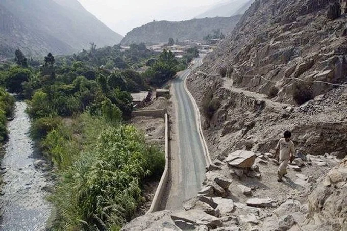
The Inca roads were built conscientiously, and they are still in operation in the outback. Compared to paved roads, they have no equal there. While paved roads regularly require repairs due to flooding in the lowlands and seismic activity in the mountains, the old Inca roads still hold and are not destroyed.