Sinking Islands: why is Kiribati sinking
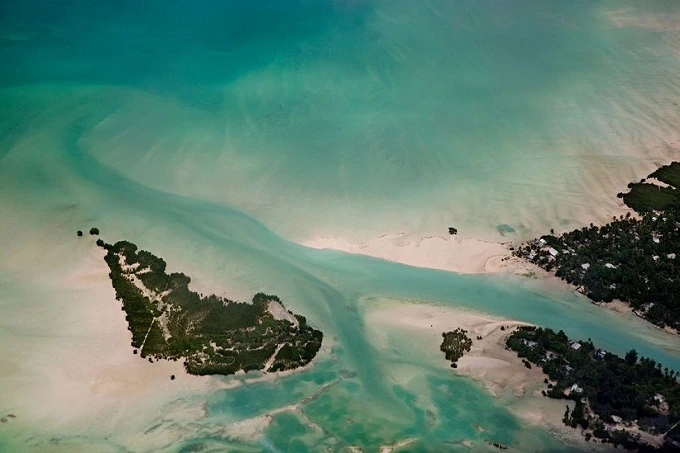
Kiribati, a Pacific island nation with 33 atolls, is one of the world’s smallest countries. Its area is reducing every year due to global warming and increasing sea levels.
According to scientists, the nation may become uninhabitable in a few decades.
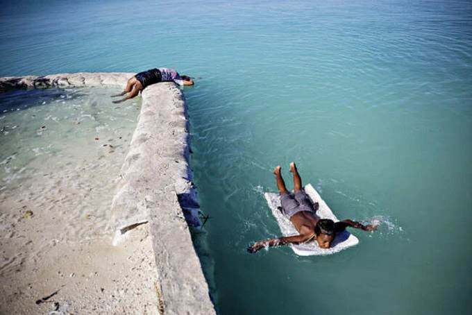
South Tarawa, Kiribati’s capital, is a chain of islands linked by a road. The lagoon is on one side, and the ocean is on the other. During high tides, many parts of Tarawa Atoll are submerged. Children from the village of Abarao are often forced to walk home from school along a flooded road. And sometimes, all you need is a piece of foam to swim with.
Because there are no rivers on the atolls, freshwater is very valuable in Kiribati. Only severe rainfall may cause it. They generate brackish water reservoirs when they seep through the earth. The islanders dig wells to get there. However, floods often render well water unsuitable for drinking and cleaning. The public water supply is switched on for a few minutes every week to allow individuals to refill their supplies.
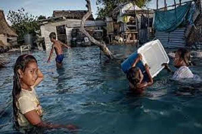
Residents of South Tarawa attempt to protect the coastline with stones and sandbags, but the barriers are pushed out to sea during storms. Houses built on low wooden piles become isolated islands when the water arrives. One-year-old infants are often tied in homes by their legs to prevent falling into the water. However, after a few years, children begin to feel like fish in the water.
Betio is the most densely inhabited neighborhood of Kiribati’s capital and is home to the country’s principal port, a power plant, and several governments and business organizations. About 16,000 people reside in one and a half square kilometers in slum-like circumstances. This location is known as the Hell of Oceania because of the high population density. The city is no longer protected from the approaching water by coastal fortifications. The Betio hospital, which stood right on the lagoon’s edge, was flooded in February 2015. Doctors were forced to deliver while knee-deep in water.
The purpose of these barriers, which are composed of stones and other supplementary materials, is to protect settlements from flooding. In actuality, water often surges over the breakwaters, destroying them regularly.
The national airline of Kiribati, Its planes fly between the Gilbert archipelago’s islands on internal flights. In addition, the firm coordinates evacuations, searches, and rescues.
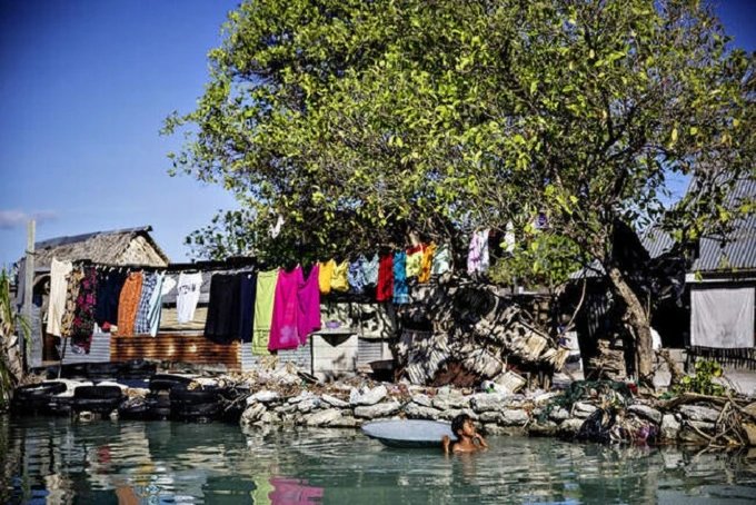
During high tides, drinking not only water wells but also toilets and pig barns in the community of Eita in South Tarawa are often flooded. The sewage has been dispersed over the region. As a consequence, diseases spread throughout the soil.
A 36-year-old woman’s home was wrecked by a high wave in 2015. “Floods happen around once a month,” adds the lady. – The high water level will continue for many days. Seawater has damaged the soil, preventing vegetables from growing. Our palm trees are withering. I like living here, but our prospects are bleak. We will all have to leave our houses very soon.”
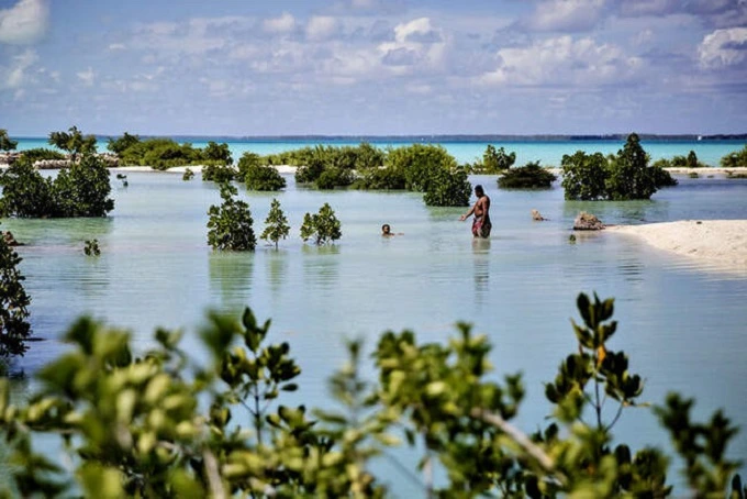
The islanders plant thousands of mangrove plants every year to fortify the beaches and preserve them from further erosion. However, this is just a temporary solution.
Kiribati’s government has been seeking a location to relocate its population for quite some time. However, having sought refuge in neighboring nations, Kiribati residents would confront additional challenges, including a lack of job, a loss of status, and, consequently, a loss of national identity.